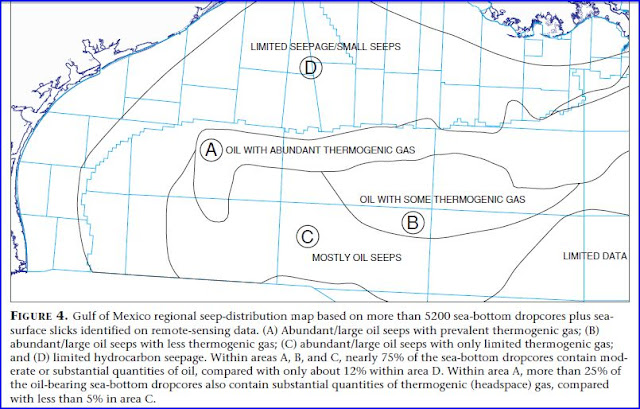
Here is the geo-data for sub-floor, in the area of the spill. Although BP won't release current logs. This is as good as it gets,
it's got all the important information. I just posted the graphics from it, if you want technical details... Link's at the bottom of the post. ...your welcome : )
Make extra certain you read the text beside figure 10 below..then you will know what they are trying to hide.
----------------------------------------------------
" Hydrocarbon Systems Analysis of the Northern Gulf of Mexico: Delineation of Hydrocarbon Migration Pathways Using Seeps and Seismic Imaging "
Kenneth C. Hood , L. M. Wenger, O. P. Gross, S. C. Harrison
Exxon Exploration Company Houston, Texas, U.S.A.
" Widespread oil and gas seepage in the offshore U.S. Gulf of Mexico has allowed the extension
of hydrocarbon systems and maturity maps far beyond well control. "
http://www.searchanddiscovery.net/documents/hood/images/hood.pdf


No comments:
Post a Comment